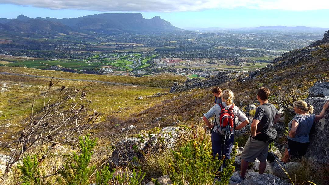
The Cape has so many amazing hiking trails that it can be difficult to pick one! We have done the research for you so that you have all the relevant information at your fingertips and can go ahead and choose the one most suited to you.
Please make wise choices… as some hikes are for experienced hikers and should not be ever done on your own. Rather do them in a group for safety purposes and pack rain gear or a jersey as the weather can change quickly on a mountain. Be sure to pack at least 1 litre of water, some snacks and some kind of sun protection, which is essential.
Table Mountain Hikes
Hiking Up Table Mountain Via Platteklip Gorge
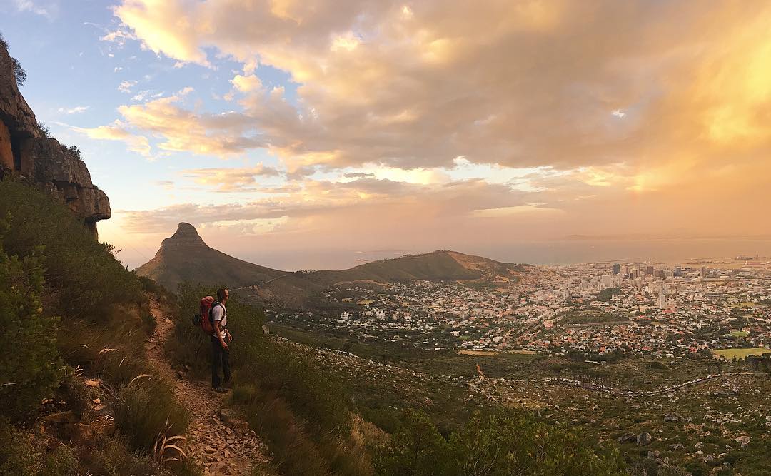
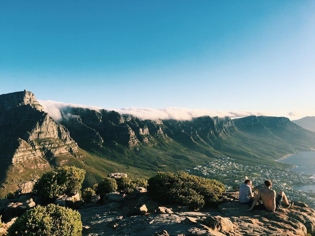
The Table Mountain cable car is the easiest way to ascend to the top of Table Mountain – the glorious natural heritage site that looms above Cape Town’s city bowl. If you seek a sense of accomplishment and physical exhilaration then ascending to the top via Platteklip Gorge is a must.
The hike begins about 1.6km after the cable car station (to the left) on Tafelberg Road and is well signposted all the way to the top.
Although it is the easiest way to climb to the top of Table Mountain, it is physically taxing, although not requiring much mountaineering skills. The 3km long trail rises by 700m and is a relentless and steep gradient to climb. Only attempt this hike if you are confident that your fitness levels will allow you to ascend at a fair pace.
It is essential to take plenty of water with you on this hike as you’re exposed to the sun for the duration of the hike and you’re not going to find any water on the mountain. You should also pack something warm in your hiking bag as the temperature often decreases by 6 to 8°C once you reach the summit.
The hike will reward you with a stunning panorama of Cape Town as you look down onto the CBD and Camps Bay. You have three choices once you reach the top of Table Mountain:
- Take the cable car down,
- Take in the views and return down via Platteklip Gorge,
- Proceed to hike even further along the multitude of hiking trails.
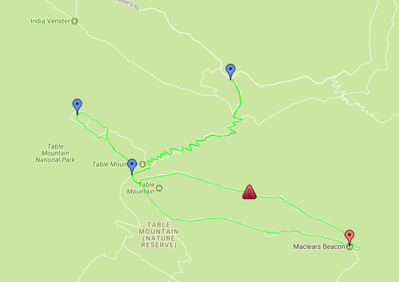
None of the routes on the top of the mountain require much skill and can actually be regarded as leisurely walks. The most prominent one would be the walk to Maclear’s Beacon which affords you a stunning view of the Cape Flats and Table Bay.
- Location:
- 1.6km after the Cable Car Station
- Distance:
- 3km (take the cable car down)
- Elevation:
- Very steep, climbs 950m
- It is fairly strenuous but well-marked
- Estimated Time:
- 3 – 4 hours
- General Contact:
- +27 (021) 712 0527
- SANParks Emergency Number:
- +27 (0)21 957 4700
- Map:
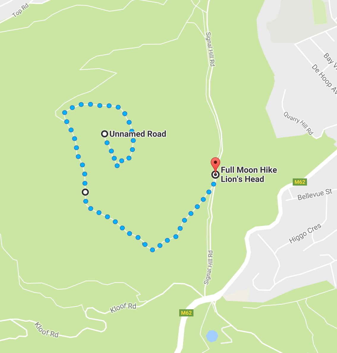
Lion’s Head Hike
The hike up Lion’s Head is iconic. It is one of the most popular hikes in Cape Town. Its gradient is not as punishing as the climb up Table Mountain and it is arguably a much prettier hike.
This is especially true when you decide to do it at sunrise or sunset. The climb yields some stunning views of the Sea Point area and you also walk through one of the highest concentrations of beautiful Silver Trees, which are endemic to the Cape Peninsula.
The hike is pretty easy to access, even without a car. Cape Town’s transport system will easily get you to Kloof Nek and then it’s a short walk up the road to Signal Hill until you reach a gravel parking area on both sides of the road. You start your ascent via the gravel road, which has a boom.
The popularity of Lion’s Head has fooled many people over the past couple of years as they assume that it is an incredibly easy hike that can be attempted in wholly inadequate footgear, or by relatively unfit people. This has resulted in a few people having to be rescued off of the mountain.
The hike can be deceptively tricky especially if you decide to use the chains to climb the rock face. It is advised to rather use the chains on the return trip if you wish to have a rather exhilarating descent.
An important point to note is that early on you shall encounter a fork in the path. The upper right fork will take you to Lion’s Head. The left hand fork will take you to Lion’s Rump – commonly known as Signal Hill.
You should bring plenty of water along for this hike and make sure to pack warm clothing if you plan to do the sunset hike. Cape Town can get icy once the sun has set, even if you’re hiking.
- Location:
- 650m up Signal Hill road
- Distance:
- 5km
- Elevation:
- 500m, but a gradual slope
- A fairly easy hike
- Estimated Time:
- Roughly 3 hours
- General Contact:
- +27 (021) 712 0527
- SANParks Emergency Number:
- +27 (0)21 957 4700
- Map:
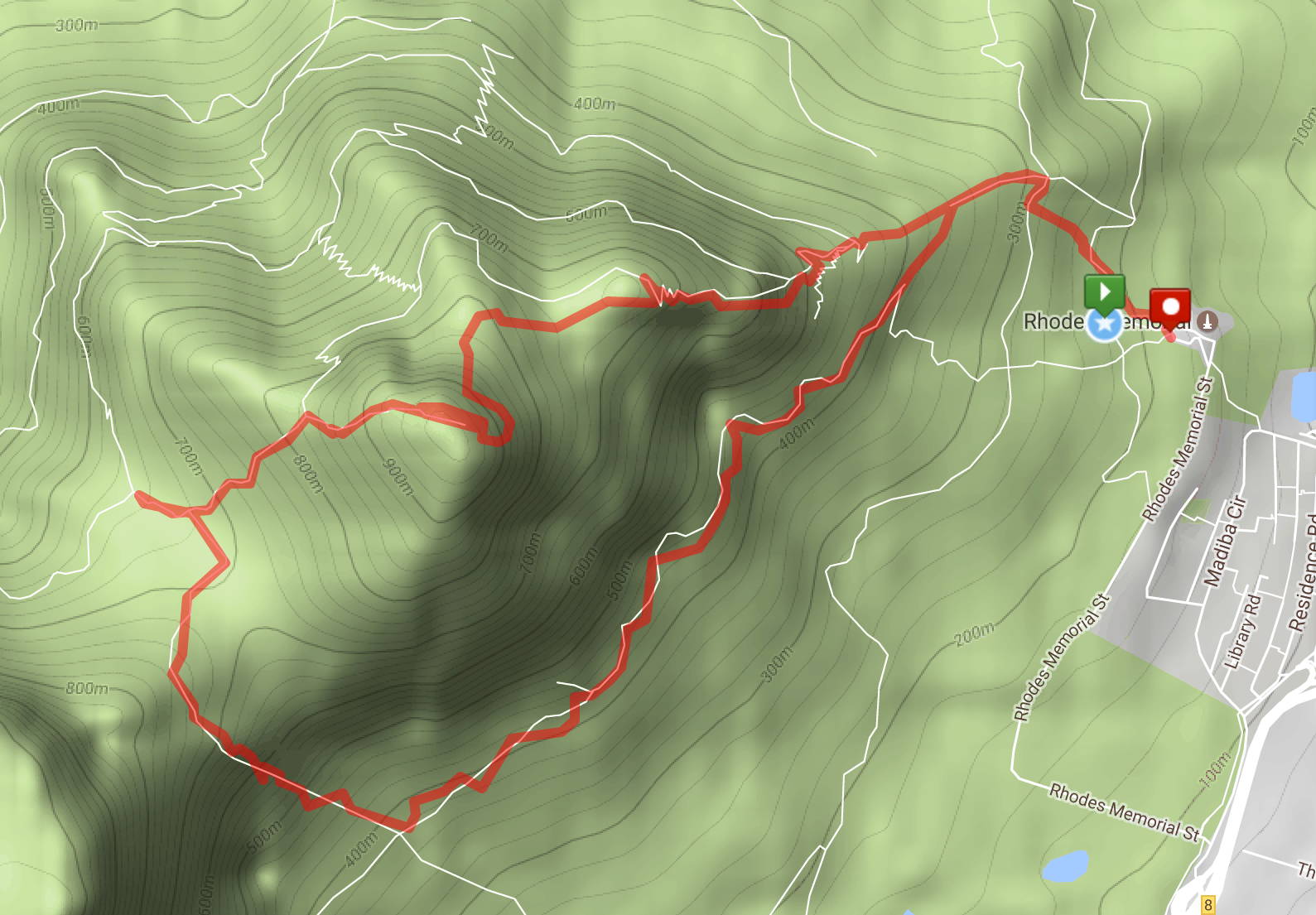
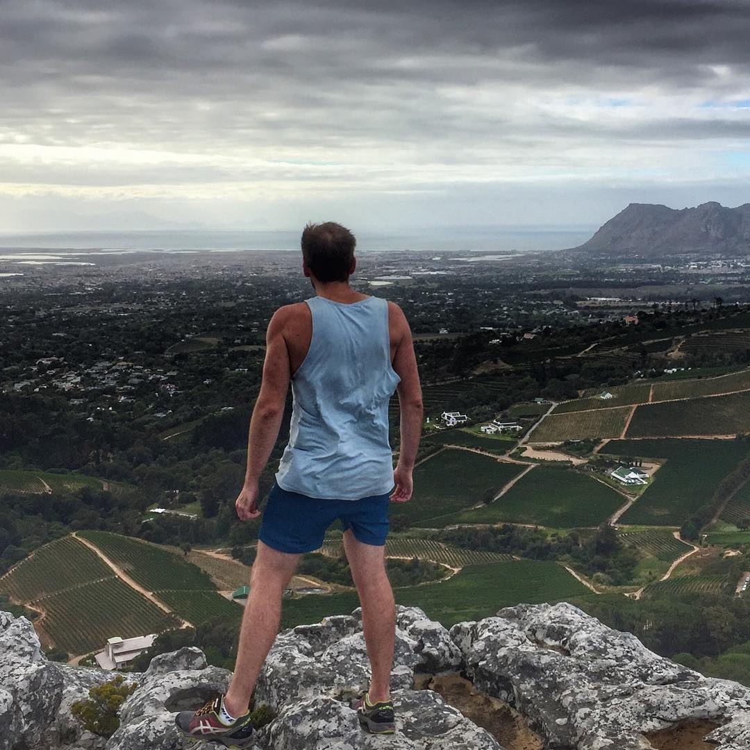
Devil’s Peak Hike

If there is one place in Cape Town shrouded in folklore – it is Devil’s Peak. The legend is that Jan Van Hunks, a regular pipe smoker that lived at the foot of the mountain, was often forced out of the house by his wife when he wanted to smoke.
One day while smoking he met a mysterious man who was also smoking. They ended up bragging about how much they smoked and entered into a pipe-smoking contest. The man turned out to be the Devil and Van Hunks ended up winning the contest. The smoke he produced formed the blanket of cloud that is called the tablecloth cloud when it covers the mountain.
Luckily, you won’t meet the Devil or Van Hunks on the hike to Devil’s Peak. There are two routes to the top. The one is an incredibly easy route that involves parking on Tafelberg Road and taking a hike up to the top.
The other route is the ascent via Mowbray Ridge and the Knife Edge Path. This is reserved for expert hikers. If you want to take on the challenge , then head on over to Rhodes Memorial, as the hike begins there.
Your first landmark is the King’s Blockhouse. Climb up to the concrete reservoir behind the Blockhouse which marks the beginning of the Mowbray Ridge. This is a good place to stop as there is usually fresh drinking water in the reservoir.
Your next landmark is a lookout hut perched on top of the cliff. The only way to get there is to ascend straight up from the reservoir. A faint path shall appear on your right a short while into ascent. Do not take that path as it will not take you to Devil’s Peak.
Take a moment to rest at the lookout and take in the view. Take note of the time, as the next turnoff from the main path you need to take should come up in 15 minutes. Continue along the main path until it starts to zig-zag.
A faint path up should appear on the fifth bend – this is known as the Knife Edge Path. You will need to take this path to get to the final ascent to the summit of Devil’s peak. You could continue along the main path to reach Devil’s Peak, but the Knife Edge Path is much more breath-taking, in terms of aesthetic beauty.
Be warned however,if you’re afraid of heights then this is not the path for you as it features precipitous drops on both sides. This path shall lead you straight to the vertical ascent up Devil’s Peak and onto some stunning views of the city.
You descend via the Saddle between Devil’s Peak and Table Mountain. Upon reaching the Saddle you shall encounter three ravines: Dark Gorge, Newlands Ravine, and Els Ravine. The first and last are reserved for experienced mountaineers as they require ropes. Rather head to the far side of the Saddle and climb up high before turning left – signposts should guide you to the top of the ravine.
You descend from the Newlands Ravine down a contour path which takes you back to the Rhodes Memorial where you can head to the tearoom for a well-deserved cup of tea.
- Location:
- Tafelberg Road
- Rhodes Memorial Route
- Distance:
- 8.5km from Tafelberg
- 13km from Rhodes Memorial
- Elevation:
- 1260m
- For experienced hikers
- Estimated Time:
- 4 hours excluding breaks
- Over 5 hours with breaks
- General Contact:
- +27 (021) 712 0527
- SANParks Emergency Number:
- +27 (0)21 957 4700
- Map:
Kirstenbosch Hikes
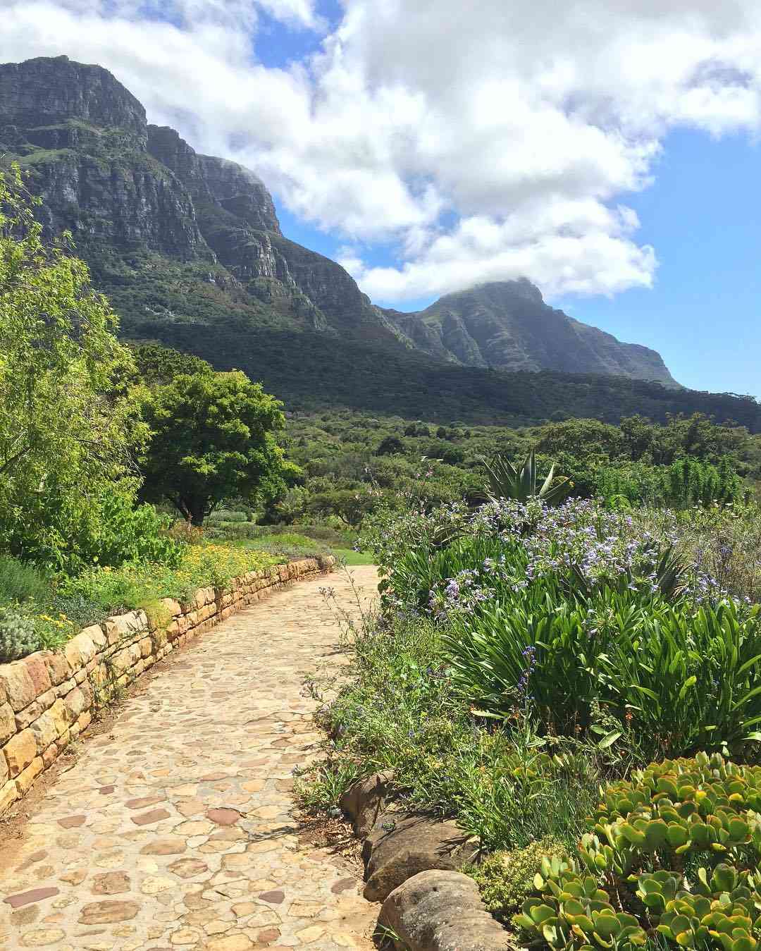
Many hikes in Cape Town either begin in the Kirstenbosch Botanical Gardens or end in Kirstenbosch. You will have to pay an entrance fee for Kirstenbosch regardless of whether you start or end your hike there. The tariffs are as follows:
- Price:
- Adults: R60
- Students: R30
- Children (6 – 17 years): R15
- Under 6 years: Free
- Botanical Society Members: Free
- (see here for how to join)
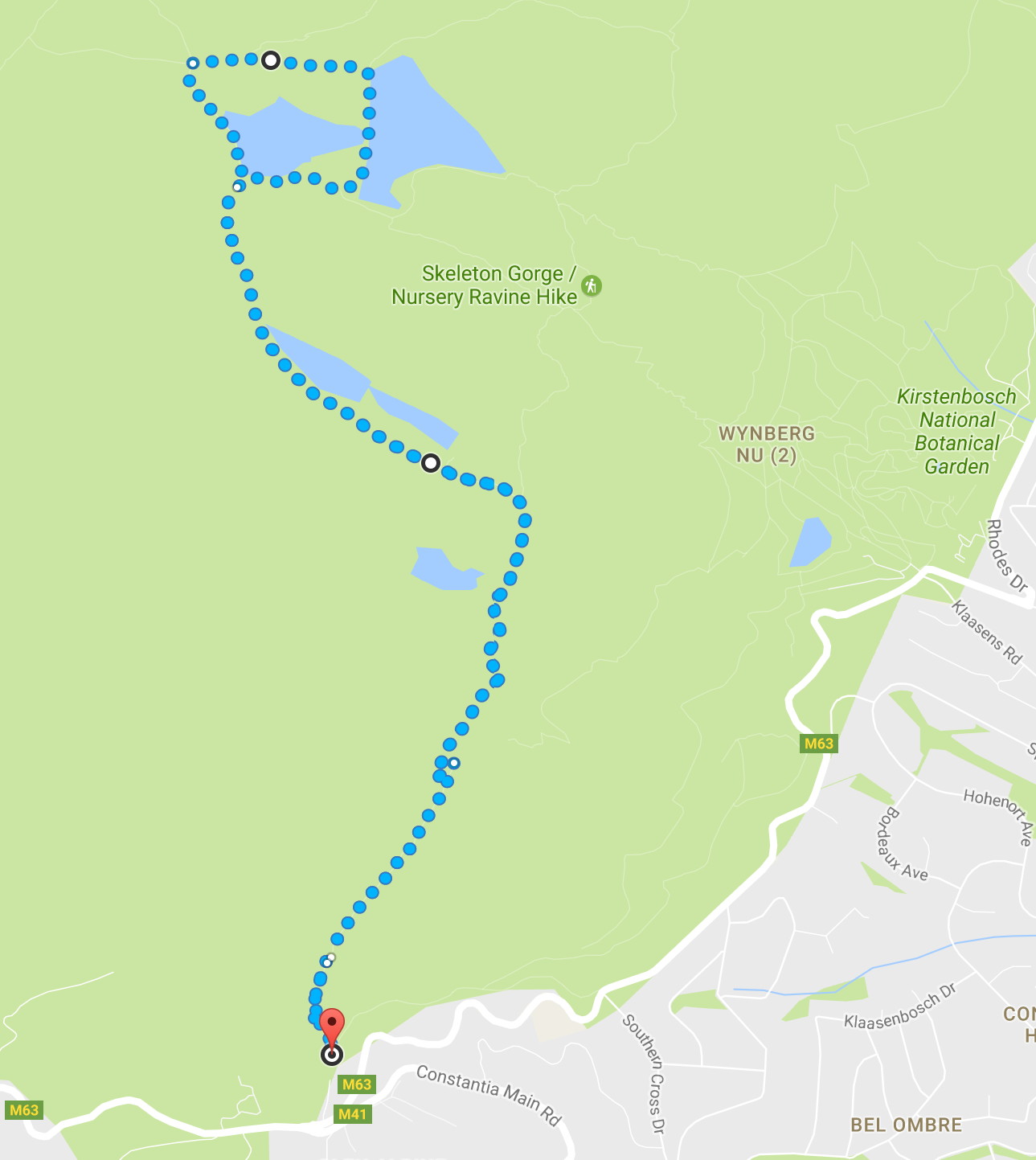
The two best hikes are as follows: the hike up Skeleton Gorge and the contour path from Constantia Nek to Kirstenbosch.
- Map:
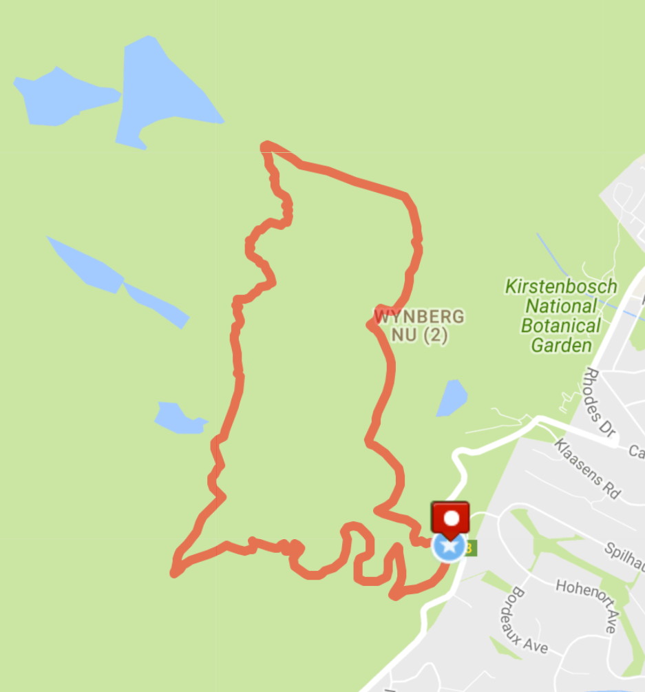
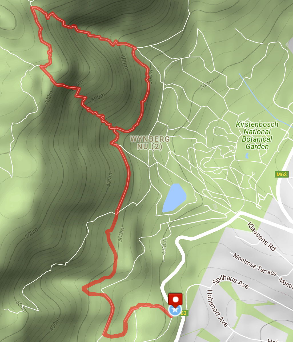
Skeleton Gorge
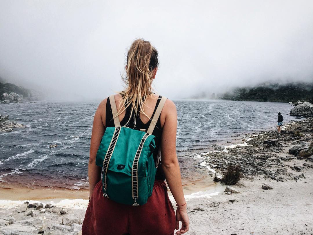
The hike is incredibly well-maintained due to its constant use and the majority of the hike is well signposted, so there is virtually no chance of getting lost.
It can be a strenuous hike due to its distance and gradient but it doesn’t require much experience, as there are only a few rock scrambles and ladders.
It is best to approach the hike via Skeleton Gorge, as opposed to climbing up Nursery Ravine. Nursery Ravine should rather be used to make the descent.
Nursery Ravine is incredibly steep and can make for a bone-jarring descent that should be done carefully. The rest of the hike is a brief walk along a contour path to get back to the Gardens where you can relax and enjoy one of the most beautiful places in South Africa.
- Location:
- Distance:
- 6.2km
- Elevation:
- 930m
- A strenuous hike but has shade
- Estimated Time:
- 3 to 4 hours
- General Contact:
- +27 (0)21 799 8783
- SANParks Emergency Number:
- +27 (0)21 957 4700
- Map
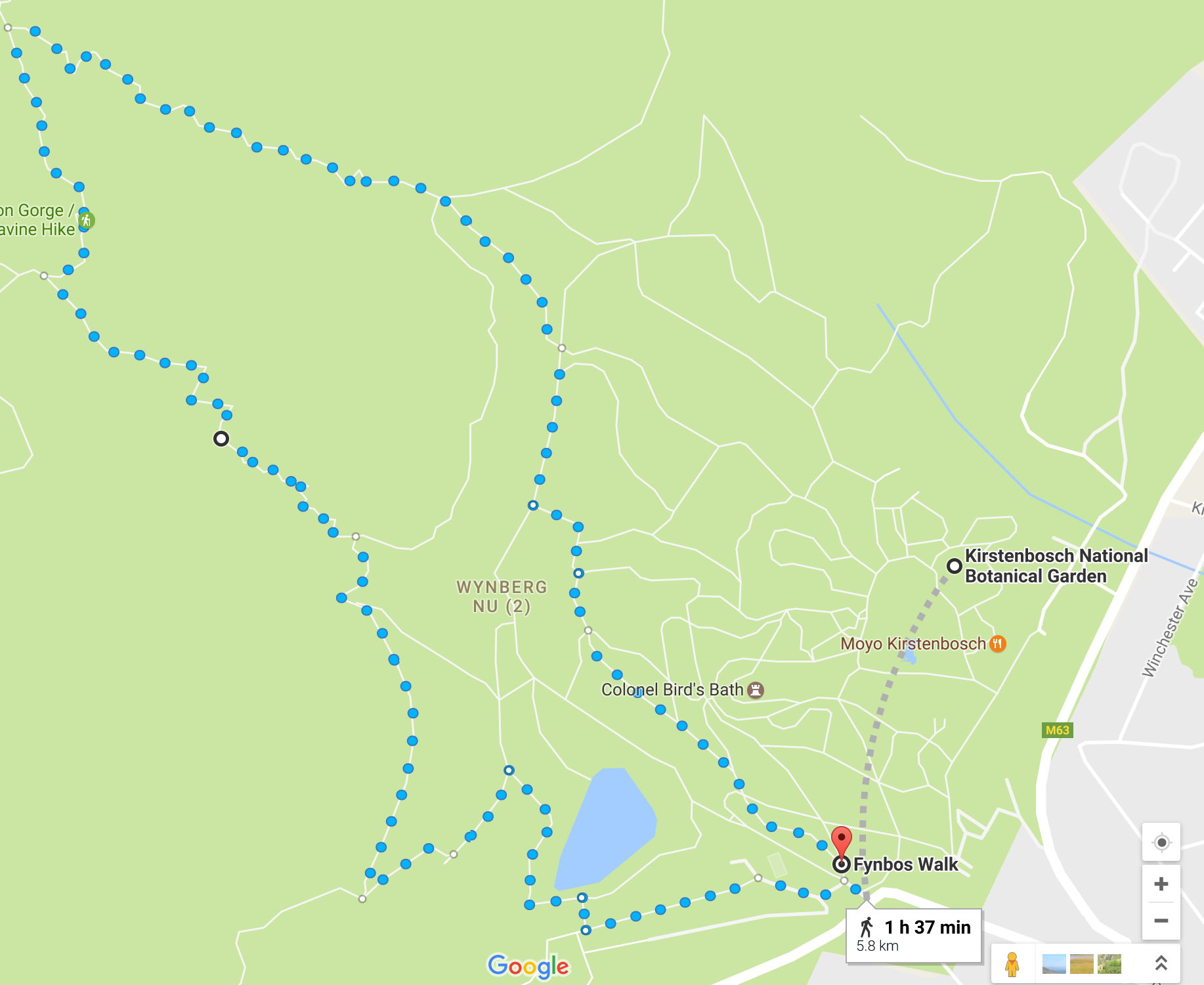
Constantia Nek To Kirstenbosch
This hike doesn’t begin in Kirstenbosch but rather at Constantia Nek and ends in Kirstenbosch. It is a favourite early morning hike as you can end it with a lovely breakfast at Kirstenbosch’s restaurant.
The contour path that you follow makes the hike an easy one and is suitable for the entire family. It is fairly lengthy as it takes about 2 hours to do one-way.
It is best to travel in two cars and leave one at Kirstenbosch so that you don’t have to walk back.
The contour path is well-maintained by its constant use. It takes you through a wonderful mixture of indigenous fynbos species and towering invasive trees that form part of the Cecilia Forest plantation. The trail is well-marked and you’ll find yourself leisurely strolling along the trail taking in all of the sights.
- Location:
- Distance:
- 5km
- Elevation:
- Relatively flat with a few hills
- Easy walk for the whole family
- General Contact:
- +27 (021) 712 0527
- SANParks Emergency Number:
- +27 (0)21 957 4700
- Map:
Hikes To Waterfalls
The mountainous nature of the Cape Peninsula and our high winter rainfall results in a number of waterfalls around the Cape Town area. They are not as majestic as the Victoria Falls, but are breath-taking nonetheless.
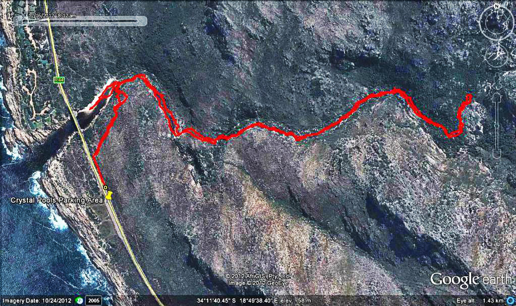
Crystal Pools Hike
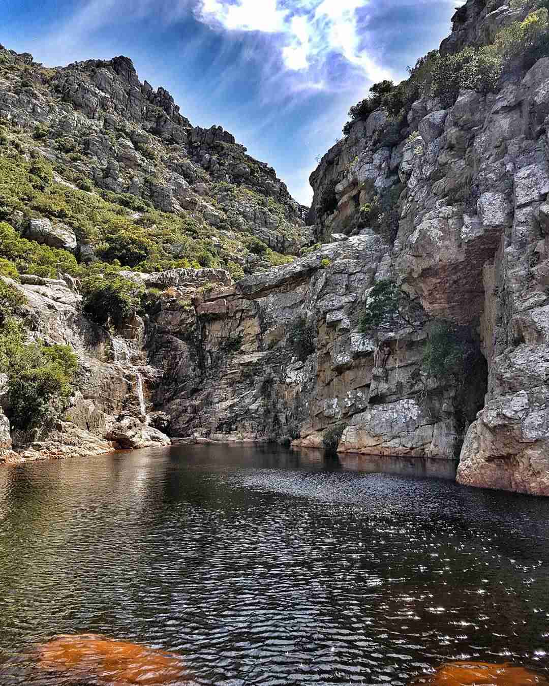
This one of the most popular waterfall hikes in Cape Town. It is situated in the Kogelbay Biosphere just outside of Gordon’s Bay near the Steenbras River mouth. The hike takes you up to the waterfall that feeds into the Steenbras River.
It is named after the fact that the hike is dotted with a series of pools that allow for an exuberant swimming experience that has made the hike so popular.
Pack in a costume or wear clothing that dries easily. Please do not dive into the pools, as they are quite rocky.
Due to it’s popularity a permit is required for the hike. The trail is limited to 50 people a day and you will need to email the City of Cape Town in order to acquire a permit. The steps are as follows:
- E-mail your name, the size of the group, contact number and the date of the hike to steenbras.naturereserve@capetown.gov.za. The minimum group size is 3 and the maximum is 10.
- Await confirmation that you have a provisional booking.
- Pay the R60 per person via EFT.
- Email your proof of payment to the City on the same email address.
- Wait for your permit to be emailed to you.
The hike is only open from 1 November to the end of April and as of this publication – the hike is currently fully booked until April.
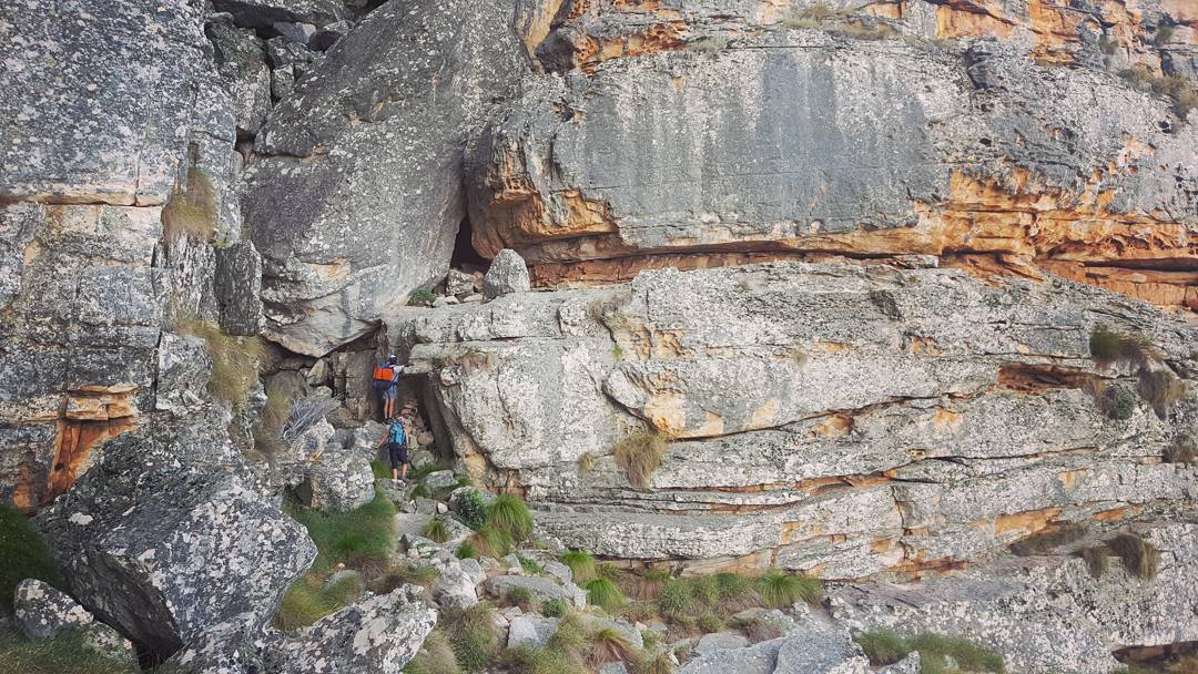
Hikers wishing to approach this hike should be relatively fit. They must also not be fooled into wearing flip-flops as the hike has some serious rock scrambles. The hike is well-marked by a series of pegs to keep you on track.
- Location:
- Parking for the hike is found along the R44 just after the bridge over the Steenbras River Mouth
- Distance:
- 5km
- Elevation:
- There are some gradual ascents
- It is a fairly easy hike but don’t take it lightly
- Estimated Time:
- Roughly two hours, but give yourself time to swim
- Map:
Cecilia Forest Waterfall
This hike is close to Cape Town and the waterfall in question is on the backend of Table Mountain. You hike up through Cecilia Forest – one of Cape Town’s many plantations, to access it.
Much of the plantation has been felled recently and replaced with fynbos, thus enhancing the natural heritage of the area. If you wish to see the trail in its full beauty then do it in spring when the majority of the trail is through flowering fynbos. The only negative aspect is that the initial stage of the hike has a lot of exposure to the sun and it is thus better to do it in the early morning or late afternoon, or on a cool and cloudy day.
The hike requires you to make your way to the edge of Kirstenbosch, along the same contour path that extends from Constantia Nek. Upon reaching the edge, you will encounter a signpost indicating the various routes.
You must take the route that points you towards the Cecilia Ravine via the way of Rooikat Ravine (labelled as Rooikatkloof on the sign). The rest of the hike is a rather steep climb up a series of wooden steps. The exertion is worth seeing the pristine and tranquil waterfall at the end of the hike. Give yourself two hours to do this hike.
- Location:
- Distance:
- roughly 4km
- Elevation:
- 460m
- It is a fairly easy hike
- One climb for half an hour
- Estimated Time:
- About 2 – 3 hours
- General Contact:
- +27 (021) 712 0527
- SANParks Emergency Number:
- +27 (0)21 957 4700
- Map:
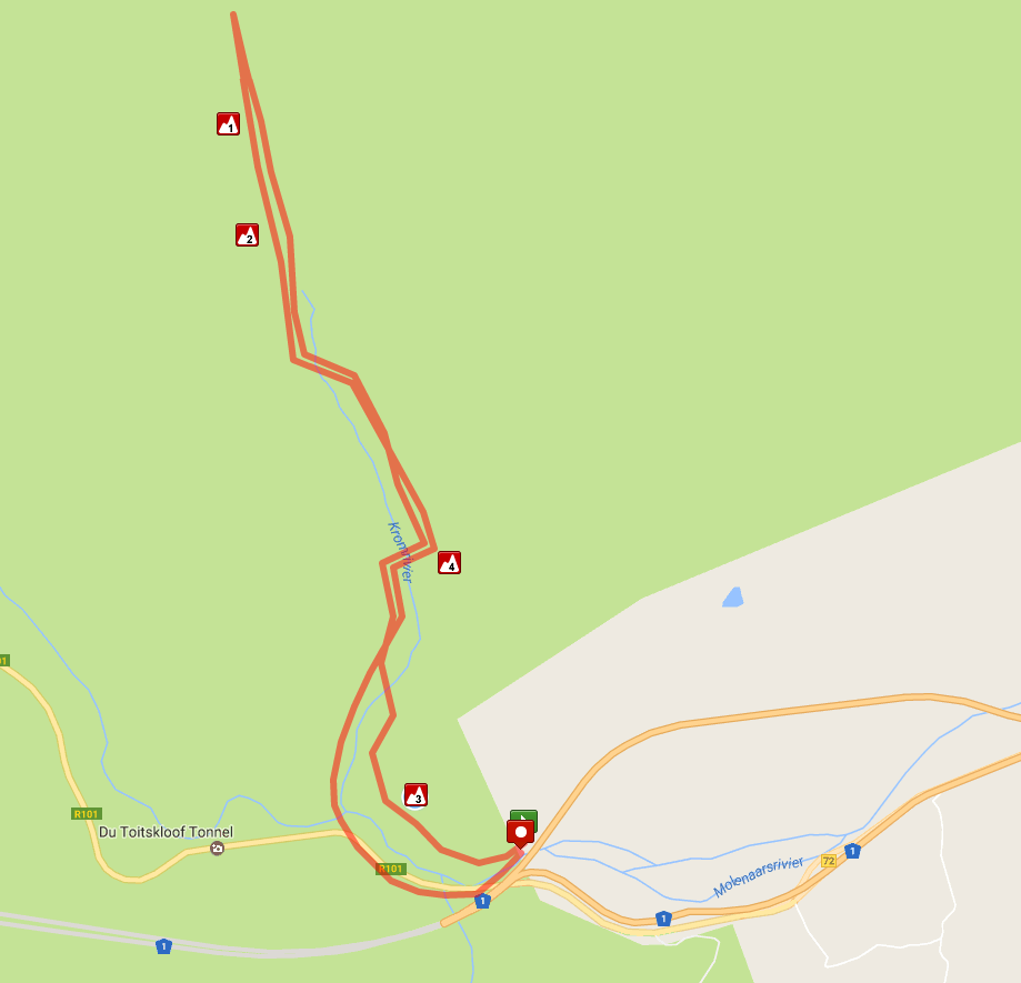
Krom River Hike
The Krom River Hike is a situated well out of Cape Town after the exit of the Huguenot Tunnel. Look for a small road on the left with an “authorised vehicle only” sign. Just like Crystal Pools, this hike requires a permit to ensure that only a few people can use the trail each day. Booking the permit:
- Contact Cape Nature on +27 (0)21 483 0190
- The permit must be booked for at least two people
- Cost: R30 per person
The hike is well marked and follows the river for a while. You will cross over the river several times before the path takes you up a ravine to a rock pool with a waterfall.
This is one of two rock pools along the hike where you can cool off. The path then continues to a bigger and better rock pool. Remember to pack your costume If you want to swim.
The trail will take you through an incredibly beautiful section of the Boland where you will be able to see some of the hardier species of fynbos that exist within the Cape Floral Kingdom.
There are sparsely dotted trees along the wetter parts of the ravine and you can find disas along the final waterfall if you look close enough.
The hike is often closed during the winter months due to the river overflowing after high rainfall. This hike is best done in summer or spring.
- Location:
- Park near the Worcester exit of the Huguenot Tunnel by the “authorised vehicles sign”
- Distance:
- 7km
- A moderate fitness level is needed for this hike
- Estimated Time:
- 6 hours
- Map:
Other Hikes Near Cape Town
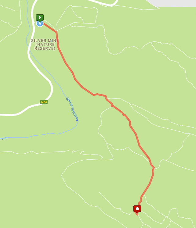
Silvermine Nature Reserve
Silvermine is an immensely popular destination for family outings and picnics. It isn’t as far away as Cape Point and the entry fee isn’t as high.
Silvermine has a stunning and easy hiking trail along a gravel road and that takes you on a full circuit of the nature reserve.
You can follow the main road from the parking lot for the duration of the hike, but there are also several trails that fork off from the main path which will take you around the reserve.
Upon leaving the car park, it is best to keep to the left as the right hand track is used on your return. This path will take you below Noordhoek Peak and take you past some truly amazing viewpoints which gives you a bird’s eye view of parts of False Bay.
You can also fork off from the main path and tackle the climb up to Noordhoek Peak if you’re looking to take in the tremendous view the peak offers. It is best to reach the top by late morning else you will be looking into the sun.
If you follow the main path it will take you to the trail that heads to Elephant’s Eye Cave. This can also be accessed from the Tokai Forest.
You can skip this trail and head back down to the car park. But you would be missing out on exploring a cave that offers a unique view of the Southern Suburbs.
- Location:
- Entrance Fee
- Adults, R50
- Children, R25
- Wild Cards, free
- Distance:
- About 9km
- The hike is moderately steep but not too strenuous
- Estimated Time:
- 3 hours
- Add an extra hour to explore the caves
- Contact:
- +27 (0)21 789 2457
- Map
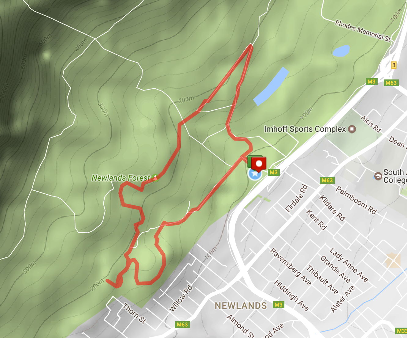
Newlands Forest
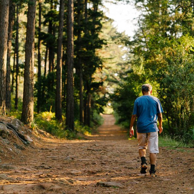
Newlands Forest is one of the more popular walking locations in Cape Town due to the towering trees which provide ample shade for a leisurely stroll through the forest.
The only downside to Newlands Forest is that it is often quite busy and the various trails within the forest are also poorly marked and inadequately signposted.
It is a confusing labyrinth of trails, but it is difficult to get lost when you bear in mind that your car is always going to be at the bottom of the slope.
You can also reach Kirstenbosch gardens from Newlands Forest via the contour path or make your way to the famous Rhodes Memorial which is perched above the gorgeous Upper UCT campus.
These are both easy hikes, but it is advised to make sure you have cars at the end of both hikes as they are fairly lengthy.
- Location:
- Distance:
- 3km per trail
- Time:
- Each circular trail can be done in just over an hour
- These are less like hikes and more like gentle rambles
- Contact:
- +27 (0)21 712 0527
- Map:
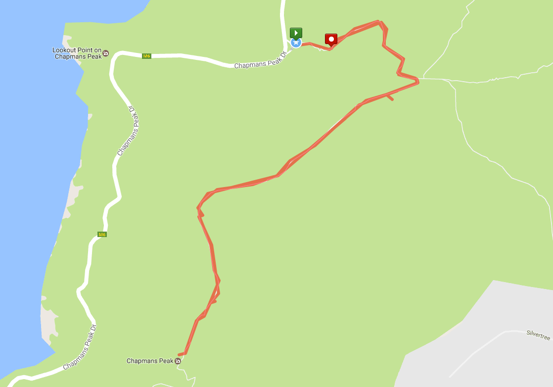
Chapman’s Peak Hike
Chapman’s Peak Drive is famous for its gorgeous views and for being a truly amazing piece of engineering. It also boasts a moderate hike that will leave you winded if you struggle with vertical inclines.
The hike is well sign-posted and the steep vertical climb will take you through beautiful indigenous fauna and give you brilliant views of Hout Bay and later of False Bay. It is an absolute must if you wish to tackle some of the best hikes Cape Town has to offer.
The hike begins just before the ticket checkpoint on Chapman’s Peak Drive so you don’t have to pay the toll fee. It is a very worthwhile hike on a windless day, to have a picnic with an amazing view.
Chapman’s Peak Drive itself was built by convict labourers. The construction started in 1915 on the Hout Bay side with the Noordhoek side being started a year later. The construction from Hout Bay to the lookout point was completed in 1919, but it was only two years later when the road from Hout Bay to Noordhoek was completed.
The drive remains a feat of engineering prowess as the City of Cape Town regularly has to find new ways to ensure that the mountain doesn’t collapse on top of the road. They have set up an ingenious series of measures to catch falling rocks as the area is prone to rock falls further along the road.
- Location:
- Above Chapman’s Peak Drive
- Distance:
- 2.5km
- Moderate hike
- Estimated Time:
- 3.5 hours
- Map: